

Challenge
71st Street, spanning from Lookout Road to SH 52, serves as a vital north-south arterial in Boulder, Colorado. This 2-mile stretch of roadway presents a unique set of challenges: a residential area to the south characterized by limited trail connectivity and ADA pedestrian access, and a rural expanse to the north with demands for upgrades to irrigation structures crossing the route and realigning the intersection with SH 52. To address these challenges and plan for growth in the region, Boulder County recognized the need for multimodal improvements that would resolve safety concerns, enhance trail connectivity, and manage heightened traffic volumes.
Solution
SEH conducted an initial assessment of the 71st Street project area as part of the County’s Transportation Improvement Program application. Building upon this foundational knowledge, Boulder County partnered with SEH to deliver conceptual and preliminary design, final construction documents, and construction assistance for enhancements to this corridor.
Various sections along the corridor required widening, mill and overlay, or full reconstruction. A 12 ft. wide multi-use path was incorporated on the north side of Lookout Road, connecting existing trails from 71st Street to Idylwild Trail. Bikeable shoulders were added along with a multi-use trail from Lookout Road to Winchester Circle with modernized crossing improvements at the connection with Lobo Trail, further enhancing safety at the intersection.
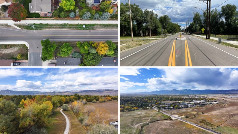
Additional improvements included the redesign of two intersections to improve safety and accommodate larger traffic volumes. Adjustments were made to the SH 52 intersections to include separate left- and right-turn lanes, redesigned to achieve a more standard 90-degree layout. A new crosswalk was also added to improve pedestrian safety.
Within the project limits, multiple irrigation ditches and waterways required replacement or extension. As part of improvements, two structures were replaced with upsized concrete box culverts, and a third structure was extended. One of these, Boulder and Lefthand Ditch, was washed out during the flooding of 2013 and constructed as a standalone project. The project also extended the existing bridge over the Boulder and White Rock Ditch and replaced the existing metal pipe at the Dry Creek #2 crossing with a new concrete box culvert.
Collaboration with the City, County, and Army Corp of Engineers was essential for determining flow rates and size requirements for culverts, with special attention to minimizing impact on right-of-way and private property. This had immediate effects on the floodplain in the area and helped determine the final impacts.
The SEH team focused on effective communication and coordination throughout the project, involving stakeholders such as Boulder County, the City of Boulder, CDOT, the ditch company, and various utilities. The corridor featured some abandoned utilities and several large electrical and gas lines that couldn't be relocated, requiring careful design solutions to work around them, particularly dealing with significant electrical transmission lines owned by Xcel.
Due to funding constraints, the team implemented modifications midway through the project, dividing the project into segments: Segment A (Lookout Road to Winchester Circle) and Segment B (Winchester Circle to SH 52). This helped confine federal funding to Segment A only and allowed a phased approach to construction, limiting the impact on traffic.
Full-depth reclamation was introduced as an added feature, contributing to sustainability by utilizing existing pavement as the road base, saving time and money. Construction phasing prioritized maintaining access to residences and businesses along the corridor, eliminating the need for extensive detours.
Spanning a 10-year design process, the SEH team navigated challenges, adjusted designs, adhered to federal and state funding requirements, and made continuous improvements – all with the goal of enhancing the safety and connectivity of 71st Street and considering future plans for the SH 119 and SH 52 interchange. As the result of careful planning and coordination, the 71st Street project not only benefits the community today but lays the groundwork for future growth and development for Boulder County.
Project
71st Street Improvements
Location
Boulder County, Colorado
Client
Boulder County
Features
- Multi-jurisdictional coordination
- Environmental impacts (multiple ditch/creek crossings with impacts requiring restoration)
- Construction phasing to maintain access to residences and businesses along the corridor
Evaluation and inclusion of updated floodplain data in the design of structures
Services
- Civil engineering
- Environmental
- Highway design
- Right-of-way
- Structural engineering
- Survey
- Traffic engineering
- Transportation planning
- Utility coordination
- Water resource engineering