

Challenge
The City of La Crosse, Wisconsin, sought to develop a mixed-use waterfront neighborhood on 65 acres of revitalized and reclaimed land just north of its historic downtown, paying homage to its rich history as a thriving river town and ensuring a seamless connection to the surrounding natural beauty. This project aimed to transform the riverfront property into a livable, walkable neighborhood with a mix of residential and commercial buildings and increased recreational, economic, and tourism-related attractions.
However, the development faced significant challenges due to the site's historical use for industrial purposes, which left behind residual contamination requiring extensive remediation. Addressing these brownfield conditions was critical to ensuring the site's safety and viability for redevelopment. In addition, portions of the site lay within the floodway and 100-year floodplain, requiring green infrastructure solutions and careful regulatory coordination to support long-term resilience.
Solution
SEH collaborated with the City of La Crosse Redevelopment Authority, Wisconsin DNR, design partners, and other stakeholders to revitalize a long-vacant brownfield at the confluence of the Mississippi, Black, and La Crosse Rivers. The result: the River Point District – a transformative infill development that now serves as a welcoming gateway to downtown from Copeland Avenue.
Designed to enhance connectivity, the district features new riverfront and multi-use trails that link the neighborhood to downtown La Crosse, expanding access to jobs, retail, and recreation.
Redevelopment of a Brownfield Site
Previously occupied by industrial uses, the site required significant environmental cleanup. All known contamination sites received regulatory closure, and any remaining residual impacts are addressed through ongoing development.
To elevate the site above the floodplain, the City secured over 200,000 cubic yards of Mississippi River dredge sand from the U.S. Army Corps of Engineers. Following FEMA’s approval of a Letter of Map Revision based on fill, the site was removed from the Special Flood Hazard Area, making it shovel-ready and primed for reinvestment.
Bringing the Community’s Vision to Life
The project focused on creating a neighborhood where residents could live, work, and recreate without relying on cars. It prioritized easy access to businesses, housing, trails, and connections to the surrounding rivers and City fabric.
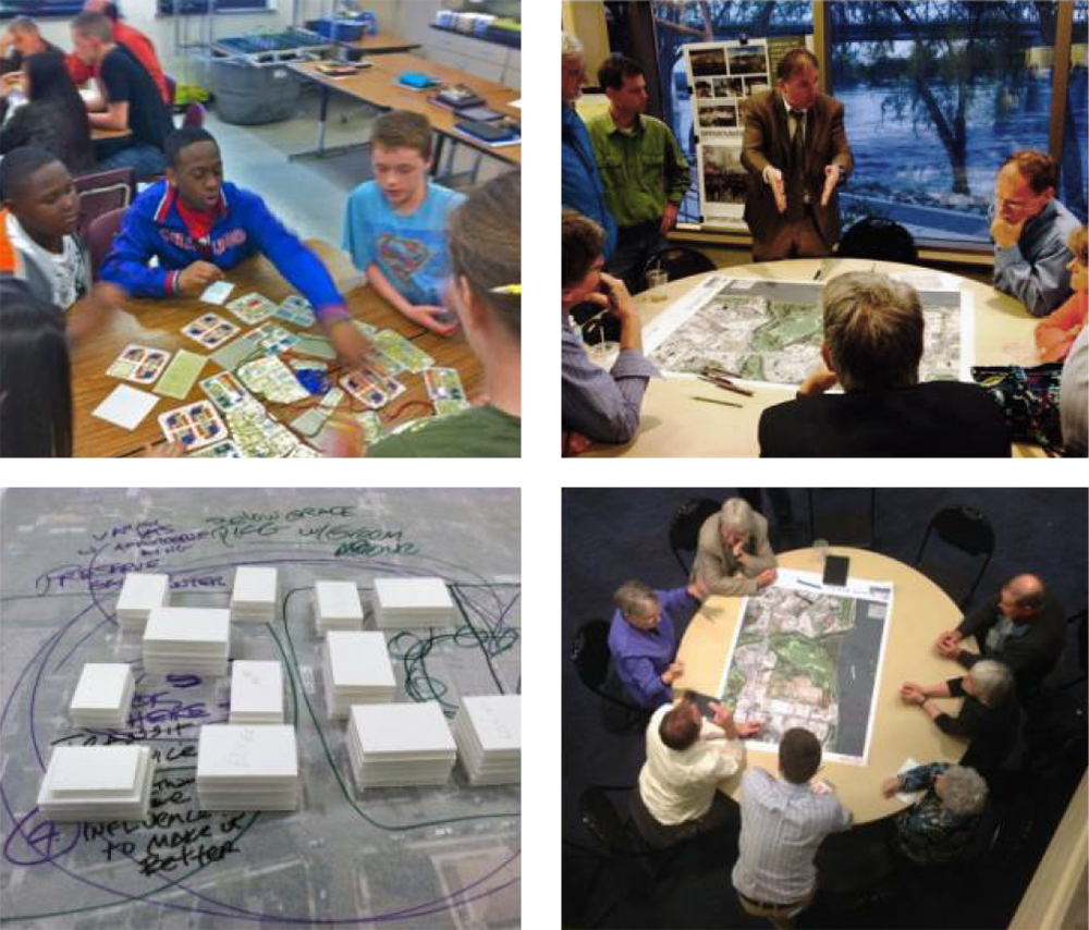
SEH planners led a collaborative engagement process to ensure the development aligned with community needs. Using the National Charrette Institute (NCI) method, they hosted a seven-day interactive workshop, supplemented by additional workshops, an online survey, and a walking tour, providing residents, businesses, and other stakeholders multiple opportunities to help shape the site’s future.
Community input informed the development of four site design alternatives that balanced the needs of businesses, residents, and visitors The outcome honors La Crosse’s riverfront heritage while embracing a forward-looking vision for urban growth, built through meaningful community collaboration.
Weaving Nature into Urban Design
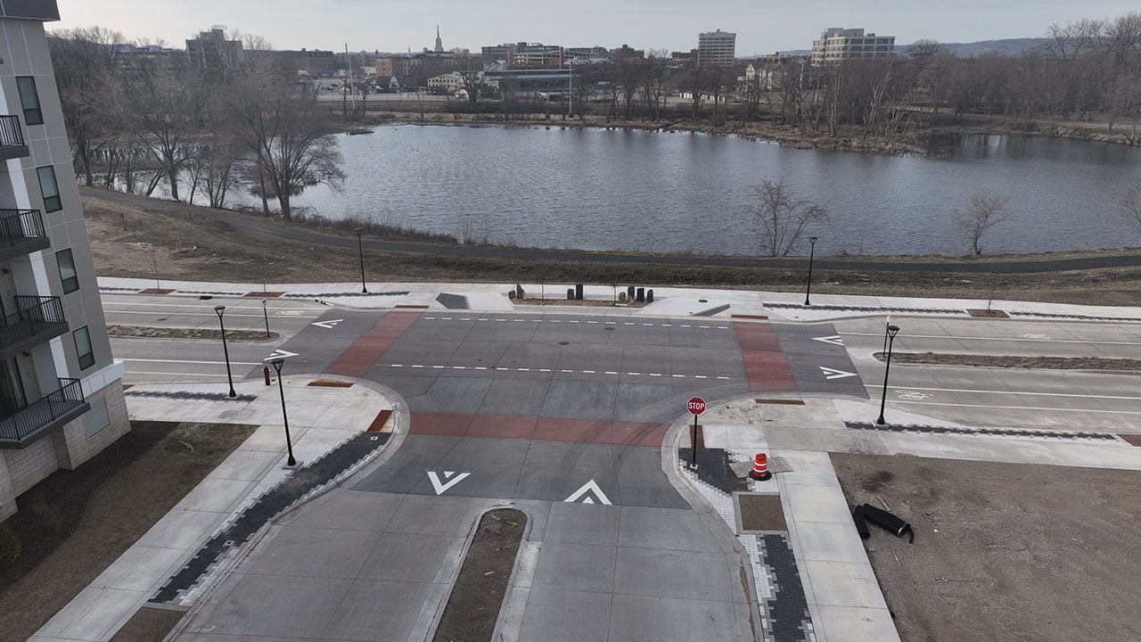
Preserving more than 30 acres of wetlands and shoreline helped shape the overall site layout. Building on this foundation, the community reached consensus on a green infrastructure plan that prioritized sustainability and enhanced the riverfront environment, allowing engineering and cost estimating to move forward. Public access improvements, a multimodal parkway, and three ecological “green fingers” now connect the riverfront to the City’s trail network and downtown core.
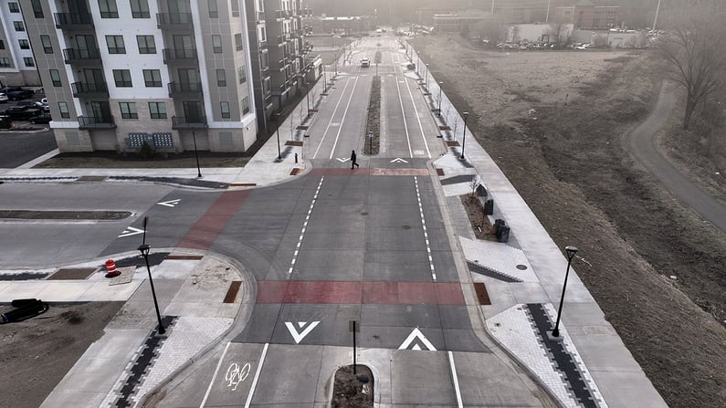
River Bend Road’s streetscape celebrates the district’s identity through flowing pavers, colored concrete intersections, native plants, and ornamental stone – all enhancing safety and sense of place.
Integrated Flood Mitigation and Sustainable Stormwater System
To make the site safe and viable for future development, a regional stormwater treatment facility was constructed beneath future park and plaza areas. This allowed for compact development above while meeting water quality requirements.
Because the site historically experienced annual flooding and much of it sat within the 100-year floodplain, fill was added to raise grades. Roadways were then designed to support first-floor building elevations at or above the 500-year floodplain, protecting the district long-term and enabling dense, sustainable redevelopment.
Catalyst for Economic Growth
The River Point District sets the stage for over 1.1 million square feet of commercial, retail, and mixed-use space, including more than 800 new housing units. This development supports economic diversification, increased recreational, economic and tourism-related attractions, and helps meet the City’s housing goals.
The final development successfully revitalizes a former brownfield site, transforming underused and contaminated land into a vibrant, walkable neighborhood. By leveraging its riverfront setting, the project delivers long-term social, environmental, and economic value to the community.
Project
River Point District
Location
La Crosse, Wisconsin
Client
City of La Crosse
Features
- Environmental scans for endangered species
- Geotechnical investigations and erosion control permits
- Regional stormwater treatment facility for better site management
- Over 1.1 million square feet of building space mixed-use spaces
- Integrated a sustainable stormwater system
- Provides better access to the Black/Mississippi River, adjacent trails, and new gathering spaces
- Economic growth through attracting recreation and tourism
Services
- Civil engineering
- Community development
- Environmental
- Geotechnical engineering
- Highway design
- Landscape architecture
- Natural resource scientists
- Planning
- Transportation planning
- Wastewater engineering
- Water engineering